CYCLE ROUTE GBEĽANY – LYSICA – VARÍN

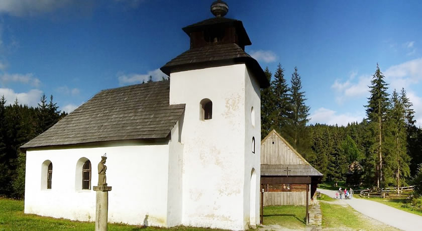
Pleasant and active relaxation is guaranteed on the easy, 20 km long route with a starting point in the square of the village of Varín and the finish in the village of Gbeľany. The road takes you to the crossroad in Žilina from where you continue to the village. Upon arrival in the village, turn right toward the saddle Žiarce along an old asphalt road. This part of the route is full of spectacular views. At the end of the saddle turn right and go downhill till you get to Lysica. Follow the signs closely. It is necessary to turn right at the chapel. Next will be a short climb up Strážovský Hill and then again a descent to the village of Stráža. Crossing the village, continue to Dolná Tižina. At the town hall turn right and pedal up to the pylon on a gravel road which leads to the Kurská Valley. When there, turn right and after about 500 m over the creek bear left toward Jedľovina. Then follow the green marks down to the village of Varín.

KYSUCE RIDGE CYCLE ROUTE

Kysuce offers an interesting training cycle route for you. It is recommended to start in Nová Bytrica. Going over the bridge you connect to the arterial cycle route that takes you to the village of Klubina. At this point you need to leave the route and, crossing the village you will get to the Klubínksy potok Creek. The climb to the Kysuce ridge starts here. After about 6 km of pedalling up, you will get to a gamekeeper´s lodge at which you have to turn right and continue up another climb to the ridge. Just below the peak, turn right to get off the asphalt road and on a forest dirt road that takes you to the highest point of the cycle route. Following the blue marks, you will come to the crossroad "Veľký potok - Nová Bystrica" from where it is possible to take a shortcut in case of bad weather or exhaustion. The route continues along the contour line toward Vychylovka - Pavelkovia. In this part the trail descends steeply, so be careful. The green marks take you to the main road leading to Vychylovka where you need to turn left and pedal down the road until you get to Nová Bystrica.

CYCLE ROUTE LUTIŠE – MRAVEČNÍK

One of the more challenging routes of the region Malá Fatra is the cycle route over the hill Mravečník which starts in the Kysucká or Terchovská valley. If you select Terchová as a starting point, you will go along an about 1 km long asphalt road, then you will turn right and follow the blue marks toward Horná Tižina from where there is a steep rise to the village of Káčerovci. Further on, the green marks will take you to Vojenné where you can indulge in beautiful views of the Kysuce Highlands. Leaving the ridge, turn left and go up a slight climb until you get to the abandoned settlement called Koštúrovci. At the linden tree grove, the route slopes gently to the left following the yellow marks which take you along the forest road to the village of Lutiše. Blue-marked asphalt road leads to the saddle Lutiška where you have two options of how to continue. One of them is the ascent of the highest peak of this stage - Mravečník Hill - from which there is a steep technical downhill with a descent of more than 500 vertical meters on a 2.8 km long stretch. Less experienced bikers, however, are recommended to opt for the route through the saddle along the yellow marks to the village of Káčerovci. From this point you can quite quickly get back to Terchová.

TERCHOVSKÝ CHOTÁR CYCLE ROUTE

A medium route across Terchovský chotár allows you to get to know the natural beauty of the birthplace of Juraj Jánošík. The first climb, at the end of which you must push your bike up, is Holešová Skala at an altitude of 846 m a. s. l. After conquering this hill, you will get on the ridge that leads to Vojenné. Going down a slight hill, watch for the signpost reading “U Zázvora” where you need to turn left, back to the ridge. After the ridge, a steep descent takes you to the village of Horná Tižina through Káčerov.

THE NOVÁ BYSTRICA WATER RESERVOIR CYCLE ROUTE

Almost 50-kilometer route goes through mountainous part of Kysuce along the water reservoir Nová Bystrica which was built between 1983 - 1989. It is located on the Bystrica River, below the confluence of the Harvelka and Riečnický potok Creeks. On the valley bottom, which is currently at the depth of almost 50 m, villages Riečnica and Harvelka are situated. As a reminder of the villages that were flooded due to the construction of the dam a church (currently a landmark of the route) was built. The start of the route is in the village of Vychylovka toward Nová Bystrica. Following the yellow marks, you can get to Terchová along this bike trail.

ORAVA CYCLE ROUTE

The region in its rich offer of bike trails includes a route suitable for recreational road bikers. Over 70 kilometer stretch with fairly heavy traffic leads from Terchová to Zázrivá. The first warm-up hill called Rovná hora comes only 5 km after the start. Next ca. 10 km long climb leads from Veľká Havrania to the saddle Hoľa. From there, a less difficult stretch continues to the center of Oraská Lesná where at the crossroad you need to turn left to Vychylovka. In Nová Bystrica you get on a new arterial cycle route leading to Radôstka. The last rising stretch is on an upward track to the saddle Lutiška from which you continue to the intersection Belá-Kubíková. At the intersection, turn left and head back to Terchová.

TERCHOVÁ – MRAVEČNÍK – ZJAZDÁRSKA

Adrenaline cycle route of Horná Tižina intended mainly for experienced bikers starts in Terchová continuing through its part Panská Lúka to the village of Káčerovci. Here, the gravel road turns into a pleasant soft grassy path which, however, takes a steep rise after a while. This difficult hike ends on the peak of Mravečník Hill at an altitude of 992 m a. s. l. from where the route only descends - it is a difficult downhill trail.

CYCLE ROUTE TERCHOVÁ – VADIČOV – BELÁ

The wide scale of cycle routes of Malá Fatra offers you another enjoyable cycle route which has got something from all - uphill, downhill, flat trails and wonderful views of the surrounding hills. After leaving Terchová, the first landmark is the settlement called Horná Tižina from where there is a rise to the settlement of Káčerov and a slight descent to Skaličanovo. After a left turn you will get on the asphalt road leading to the saddle Lutiška. When there, turn right and continue up to the saddle Nad Melišovcami. After a left turn there is an enjoyable downhill trail through a forest that connects to a gravel road leading to Hájnica Hotel in Horný Vadičov. Continue to the village and approximately in its center there is a signpost where you need to turn left. Your next destination is the ridge above the village of Lysice, near the saddle Jalovec. First, you need to go over the bridge in Vadičov, then turn left and go uphill. After about 250 m bear right. You will get onto a dirt road that leads to the aforementioned ridge. After a while the road begins to descend on the way to Lysica from where you need to get to the center of Belá. Then turn right and go up the village, after about 150 m bear left and go up the hill to the right and immediately after that turn left again onto a dirt road that leads to the Bránica Valley. Old asphalt road will take you to the intersection where Bránica Hotel is situated. After a left turn there is the final climb up the hill where the contour line leads through settlements Mažgútovci, Belovci, Podolina and finally to Terchová.

CYCLE ROUTE ŽILINA – DOLNÁ TÍŽINA – LYSICA

This medium cycle route is mainly intended for mtbikers since there are various surfaces - asphalt, pebble gravel and clay. From Budatín through the Žilina Dam there is easy terrain which turns in a rise in Varín through Jedľovina to Dolná Tižina, up Lysica to the saddle Žiarce leading to Kotrčiná Lúčka. The last climb is on the way to Zástranie after which a descent to Žilina follows.

THE ŽILINA DAM CYCLE ROUTE

Relax and unique views are guaranteed along the easy bike trail around the Žilina Dam. Its length and a slight rise will discourage neither children nor active seniors. The trail takes you to the foot of the castle Strečno, to the ferry across the Váh River. Crossing the bridge to Nezbudská Lúčka, you get to the Starhrad Castle.

logo_programu_custom

QUALIFIED TOURISM PORTAL created within the project "Bodybuilding - jointly strengthen cultural, tourism and sport in Terchova, Bela and Jaworze."

logo_programu_custom

The project is co-financed by the European Union from the European Regional Development Fund and Cross-Border Cooperation Programme Poland - Slovak Republic 2007-2013.

Go to Top