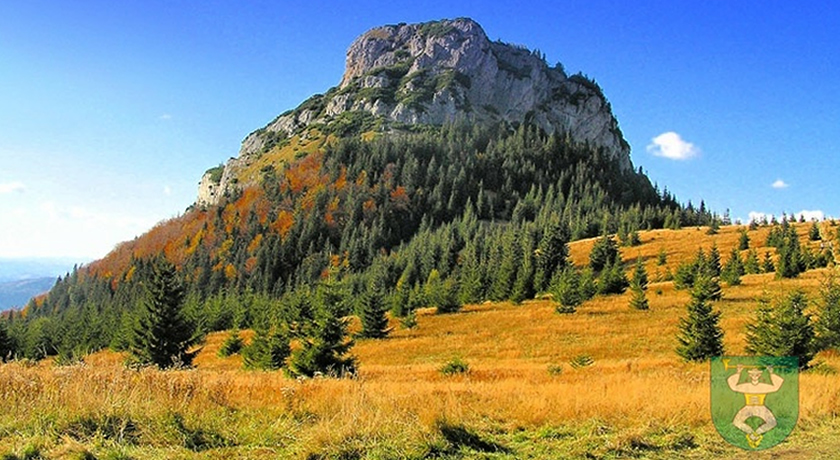
VEĽKÝ KRIVÁŇ FROM VRÁTNA DOLINA

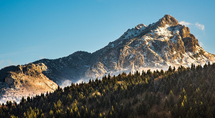
Veľký Kriváň (1 708.7 m a.s.l.) is the highest mountain of the Mala Fatra Mountains. It sits on the main ridge of the Kriváň part of Mala Fatra which bears his name. This meadowy mountain with a peak above the upper limit of mountain pine growth is an excellent scenic points with a panoramic view. It neighbors with the mountains of Pekelník (1,609 m a.s.l.) and Chleb (1 645.6 m a.s.l.) and are separated by two mountain saddles, namely Bublen (1,610 m a.s.l.) and Snilovské saddle (1524 m a.s.l.). The southern, eastern and western slopes are susceptible to avalanches.

MALÝ ROZSUTEC (SMALL ROZSUTEC)

Small Rozsutec (1 343.5 m a.s.l.) is located in the eastern part of the Krivánska Malá Fatra mountains. It is characteristic by its rock spirelets which tower 750 meters above the steep limestone cliffs of the gorge of Biely potok (the White Creek). From the peak, which is a part of the nature reserve Rozsutec there is a panoramic view of the neighboring Veľký Rozsutec (Big Rozsutec) as well as eastern parts of the northern side of the massif. Rare calcicole flora grows in the surrounding area.

VEĽKÝ ROZSUTEC (BIG ROZSUTEC)

Big Rozsutec (1 609.7 m a.s.l.), a mountain in the Krivánska Mala Fatra, is considered one of the most beautiful in Slovakia. It is situated in the heart of the National Park Malá Fatra and became a symbol of this mountain range. In the past it was rumored to have a gold treasure near the summit stashed by Jánošík himself. Rozsutec dominates the whole area, especially its 160 meter high west flank. It has one of the richest botanic ecosystem in the country. Many endemic species can be found it the area.

JÁNOŠÍKOVE DIERY

Jánošíkove diery or only Diery (Holes) is a system of gorges and canyons in the Krivanska Mala Fatra. It is located in the NNR Rozsutec. It consists of three parts: Dolné diery, Nové diery a Horné diery. They were shaped by the Dierový. There are more than 20 waterfall in the locality and together they form Vodopády Dierového potoka (Waterfall of the Dierový stream). Unusual rock formations with their specific climate have become a home to several species of plants and animals.

EDUCATIONAL TRAIL THROUGH JANOSIK’S COUNTRY

This educational trail will guide you through the picturesque hamlets in the loop 13.5 km long and you can learn a great deal of information about the region of Terchová. To walk the whole length takes approximately 6 hours starting and ending in Terchová. The path winds through a less difficult landscape with solitary houses and farms scattered across the valley Struháreň in the Kysuce Highlands. It is situated to the north of the village and provides hikers with excellent lookout over the surrounding countryside. In case of favorable weather it can be hiked all year round. The part is suitable for hikers as well as cyclists and cross-country skiers in the winter. The trail is crossed by many other hiking trails, so you have numerous options in case you want to try some other descend or take a different route.

logo_programu_custom

QUALIFIED TOURISM PORTAL created within the project "Bodybuilding - jointly strengthen cultural, tourism and sport in Terchova, Bela and Jaworze."

logo_programu_custom

The project is co-financed by the European Union from the European Regional Development Fund and Cross-Border Cooperation Programme Poland - Slovak Republic 2007-2013.

Go to Top